Rasuwa, Nepal - The catastrophic flash floods that swept through Nepal’s Rasuwa district and areas along the Nepal-Tibet border on August 26 have raised a critical question: Could the disaster have been predicted?
Scientists now say there were warning signs-but detecting them in time was far more difficult than simply monitoring rainfall or river levels.
The disaster began high in the Himalayas near the Langtang range, where a large mass of glacier ice and rock collapsed, sending an enormous volume of ice, rock, mud and water into the Lhende River system. The resulting cascade rapidly transformed into a devastating debris flow and flash flood that tore through downstream settlements and infrastructure.
Recent analysis of satellite radar imagery has provided one of the most important clues. Researchers examining Sentinel-1 satellite observations found that the glacier-rock mass had been moving before the collapse, with evidence of accelerated movement in the period leading up to August 26. The discovery shows that the mountain system was undergoing measurable deformation before it failed.
However, scientists caution that this does not mean the collapse could have been predicted with certainty.
Glaciers and unstable mountain slopes can move for weeks, months or even years without suddenly collapsing. Detecting accelerated movement can identify a potentially dangerous area, but it does not necessarily indicate exactly when-and whether-a catastrophic failure will occur. In this case, the satellite observations could potentially have prompted closer monitoring, but they were not, on their own, a reliable countdown to disaster.
Another problem was that Nepal’s existing flood-warning infrastructure is primarily designed around rainfall and river-level changes. At around 8:40 a.m. on August 26, shortly after the collapse, a river gauge on the Bhote Koshi near the Nepal-China border reportedly showed a relatively low and falling water level. The extraordinary surge came so suddenly that conventional river monitoring provided little advance warning.
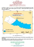
Nepal's disaster alert was reportedly issued about 38 minutes after the glacier collapse-a delay that was particularly significant because the flood travelled through steep Himalayan valleys at extraordinary speed. By the time warnings reached some communities, the destructive flow was already approaching or had arrived.
The event also highlights a major technological and institutional gap: different warning systems are designed to monitor individual hazards, while Himalayan disasters are increasingly becoming cascading events.
A glacier collapse can trigger an avalanche, landslide, temporary river blockage, debris flow and flash flood within minutes or hours. Monitoring only rainfall, river levels or known glacial lakes cannot capture the entire chain of hazards.
The August disaster therefore points to the urgent need for a more integrated Himalayan early-warning system combining satellite radar, optical imagery, seismic monitoring, glacier and slope observations, river gauges and automated data analysis. Real-time information sharing between Nepal and China is equally important because mountain hazards do not respect political boundaries.
Climate change adds another layer of concern. Warming is reshaping Himalayan glaciers, frozen ground and mountain slopes, potentially increasing the conditions for complex interactions between ice, rock and water. Scientists, however, caution against claiming that climate change alone caused the August 26 collapse; establishing a specific causal link requires further research.
The central lesson is therefore not that scientists simply “missed” an obvious warning.
The warning signals existed-but Nepal did not yet have a system capable of reliably converting subtle changes high in the mountains into an immediate, actionable warning for people living downstream.
For a climate-sensitive country like Nepal, the August 26 disaster is a powerful reminder that early warning can no longer focus only on rising rivers and heavy rainfall. The next Himalayan catastrophe could begin with a few millimetres of movement in a remote glacier or unstable mountainside-far above the communities that ultimately bear the consequences.
The challenge now is not only to monitor the mountains, but to turn what scientists can see from space into warnings people can act on in time.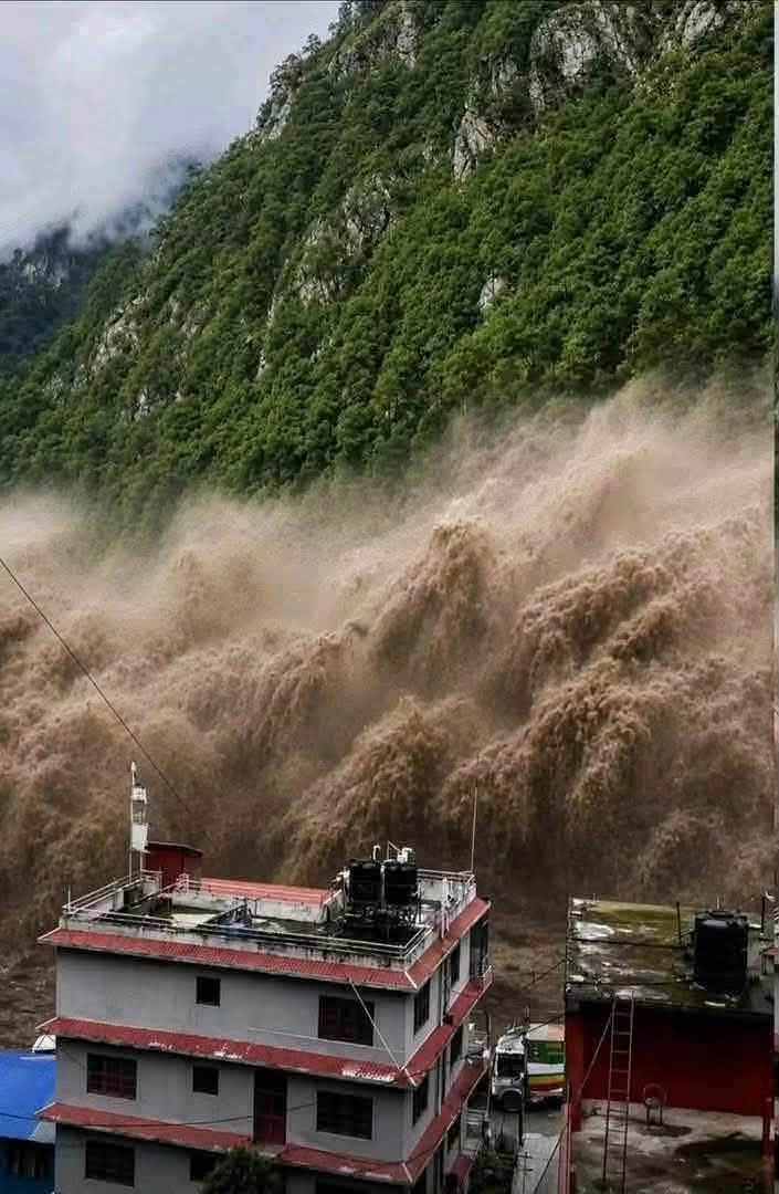
#EcosphereNews #Nepal #Himalayas #ClimateChange #GlacierCollapse #FlashFlood #EarlyWarning #Rasuwa #BhoteKoshi #Langtang #GlacialHazards #ClimateCrisis #HimalayanClimate #DisasterRiskReduction #GLOF #MountainHazards #ClimateResilience #NepalFloods #Cryosphere #SustainableDevelopment