Kathmandu, Nepal - In a country where mountains, monsoon rains, rapidly changing weather and fragile settlements intersect, weather science is becoming an increasingly important line of defence against disasters.
For Nepal, the challenge is no longer simply forecasting whether rain will fall. The greater challenge is determining where extreme weather could cause damage, which communities and infrastructure are exposed, and what action should be taken before disaster strikes.
That shift-from reacting to disasters after they occur to acting on scientific information beforehand-is at the heart of Nepal’s evolving approach to climate resilience.
The need has become painfully clear following the catastrophic August 26, 2026, flash flood in the Bhotekoshi-Trishuli river system, when a sudden flood surge entered Nepal from the Tibetan side and travelled downstream through the Bhotekoshi and Trishuli rivers before reaching the Narayani system. A technical assessment reported that authorities received information about the major flood surge at 9:05 a.m. that day.
The disaster exposed how quickly a hazard originating in the high Himalaya can cascade through river valleys, settlements and critical infrastructure. Nepal and China have subsequently agreed to strengthen the exchange of meteorological information, underlining the importance of transboundary monitoring and early warning for Himalayan river systems.
From weather observations to early action
Nepal's Department of Hydrology and Meteorology (DHM) has been expanding and modernizing its observation and forecasting systems, reducing reliance on traditional manual observations and increasing the use of automated monitoring.
The country's meteorological service now provides real-time observations, three-day forecasts, weather warnings, impact-based forecasts and specialized services, while its climate services include seasonal outlooks, climate monitoring and heat- and cold-wave monitoring.
This expanding observation network is particularly important in the mountains, where complex terrain can produce highly localized weather conditions that conventional networks may fail to capture adequately.
The challenge is even greater at high elevations, where relatively sparse observations make it difficult to understand rapidly changing Himalayan atmospheric conditions, precipitation and temperature patterns.
For Nepal, filling these data gaps is not merely an academic exercise. Better observations can improve forecasts, strengthen flood and landslide warnings and provide more reliable information for communities living downstream of glaciers, steep slopes and unstable river systems.
The rise of Impact-Based Forecasting
One of the most important developments is the growing use of Impact-Based Forecasting (IBF).
Traditional forecasting might tell people that a particular area could receive heavy rainfall. Impact-based forecasting attempts to answer the more important question: What could that rainfall do?
It combines information about hazards with exposure and vulnerability to help identify likely consequences and recommended actions.
Nepal has been piloting and expanding IBF through collaboration between government agencies, local governments and technical partners. Current initiatives include municipal-level bulletins and colour-coded warnings designed to help communities and authorities make decisions before floods, landslides and other hazards occur.
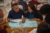
In 2026, the approach is also being advanced for extreme heat. A national demonstration supported by the Regional Integrated Multi-Hazard Early Warning System (RIMES) and the South Asia Hydromet Forum brought together government, local authorities, humanitarian organizations, academia and other stakeholders to strengthen impact-based forecasting for heat hazards.
This represents an important change in the philosophy of disaster management: the forecast should not end with a weather number; it should lead to a decision.
Communities can become part of the observation network
Technology does not always have to be expensive to be effective. In Nepal's remote mountain communities, citizen-science initiatives are demonstrating how simple, locally maintained instruments can supplement formal monitoring networks.
The Citizen Science for Disaster Resilience (CSDRR) initiative in Dordi Rural Municipality of Lamjung and Nason Rural Municipality of Manang uses low-cost tools including rain gauges made from recycled soda bottles and bamboo staff gauges for monitoring water levels. Communities can collect observations and share them through mobile-based systems, helping generate localized information in areas where conventional monitoring coverage is limited.
Training under the initiative has involved local citizen scientists in rainfall monitoring, disaster-risk understanding and digital reporting. Such approaches can strengthen community ownership of early warning while connecting local observations with broader scientific and disaster-management systems.
This model is particularly relevant to Nepal's rugged geography, where a single national observation network cannot capture every stream, slope and valley.
Putting forecasts into farmers' hands
Weather science also has a direct role in protecting Nepal's agricultural economy.
Projects supported through the UN Environment Programme's Climate Technology Centre and Network have worked on customized weather and climate information systems designed to translate technical meteorological forecasts into location-specific three-day information for farmers through mobile and internet-based SMS. The objective is to make forecasts easier to understand and use for decisions such as irrigation, harvesting, farm inputs and protection against extreme weather.
Nepal's DHM has also expanded its agro-meteorological services, including weekly agricultural weather bulletins and crop-specific meteorological product development.
For smallholder farmers, the value of such information is practical: a forecast received early enough can influence when crops are irrigated, harvested, sprayed or protected from extreme rainfall and heat.
Science must reach the last mile
The experience of the Bhotekoshi-Trishuli disaster also highlights a difficult reality: having scientific information is not the same as successfully warning people.
Warnings must travel from satellites, sensors and forecasting centres to provincial and local authorities, emergency responders and ultimately households.
They must also be understandable, timely and trusted.
Nepal's impact-based forecasting work has identified localized impact data, vulnerability information and last-mile communication as important challenges. Because national agencies cannot maintain detailed impact information everywhere, local governments and community-level actors have an essential role in maintaining information about exposed settlements, damaged infrastructure, changing river conditions and emerging hazards.
The country therefore needs not only more sensors, but better connections between science, government and communities.
Combining engineering with nature
Weather information becomes even more valuable when it is connected to practical risk reduction.
In landslide-prone mountain settlements, scientific hazard mapping can guide slope stabilization, drainage improvements, vegetation-based bioengineering and other nature-based measures. Contour trenches, catchment ponds and appropriately selected native vegetation can help manage runoff and reduce erosion when they are designed according to local terrain and hydrological conditions.
These measures cannot eliminate extreme hazards. But combined with improved observation, forecasting, early warning, land-use planning and resilient infrastructure, they can reduce exposure and give communities more time to act.
The lesson from August 26
The Bhotekoshi-Trishuli disaster should therefore be viewed not only as a humanitarian tragedy but also as a warning about the scale of risk emerging across the Himalayan region.
The August 26 flood demonstrated how a rapidly developing high-mountain hazard can move across borders and river systems and affect communities far downstream. The event has also reinforced the importance of cross-border information sharing between Nepal and China.
For Nepal, climate resilience will increasingly depend on whether scientific information can move faster than the hazard itself.
That means expanding high-altitude observations, improving hydrological and meteorological models, strengthening impact-based forecasting, integrating local citizen observations, improving agricultural climate services and ensuring that warnings reach people in forms they can immediately understand and act upon.
The future of disaster management in Nepal cannot be built solely around rescue after catastrophe. It must be built around knowledge before catastrophe.
Weather science, when combined with community participation, resilient infrastructure, nature-based solutions and effective governance, can turn early information into early action-and early action into lives saved.
For a climate-vulnerable Himalayan nation, that transformation is no longer optional. It is becoming a necessity.
#EcosphereNews #Nepal #WeatherScience #ClimateResilience #ClimateChange #Himalayas #Bhotekoshi #Trishuli #BhotekoshiTrishuliFlood #FlashFlood #EarlyWarning #ImpactBasedForecasting #DisasterRiskReduction #DHM #Meteorology #Hydrology #CitizenScience #ClimateAdaptation #GlacialHazards #GLOF #LandslideRisk #ResilientNepal #NatureBasedSolutions #ClimateAction #HimalayanClimate #DisasterPreparedness