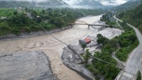
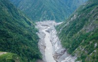
Kathmandu, July 14 - Monsoon-induced inundation continues to pose one of the most significant environmental and humanitarian challenges across Nepal's Tarai region, with districts including Jhapa, Morang, Sunsari, Banke, Kailali, and Kanchanpur remaining highly vulnerable to prolonged flooding and waterlogging during the rainy season.
According to the Department of Hydrology and Meteorology (DHM), monsoon conditions remain active across much of the country, with moderate to heavy rainfall forecast in several provinces during the current monsoon period. While no nationwide flood emergency has been declared, authorities continue to closely monitor river levels and advise communities living near rivers and low-lying areas to remain alert.
Experts say Tarai inundation is driven by a combination of natural and human-induced factors. Cross-border embankments, roads, and other infrastructure along the Nepal–India border can obstruct the natural drainage of floodwaters, causing water to accumulate in Nepali settlements and agricultural land. At the same time, climate change has increased the frequency of intense rainfall events, while rapid urban expansion, inadequate drainage systems, and unplanned road construction have worsened localized flooding.
Environmental degradation in the Chure (Siwalik) hills has further intensified the problem. Deforestation and land degradation in the fragile watershed reduce the landscape's capacity to absorb rainfall, increasing surface runoff, sediment transport, and sand deposition on fertile farmland across the Tarai.
The impacts extend well beyond floodwaters. As Nepal's agricultural heartland, the Tarai produces a substantial share of the country's food supply. Flooding damages standing crops, destroys livestock, disrupts transportation, and threatens food security. Stagnant water also raises the risk of waterborne and vector-borne diseases, including cholera, diarrhoea, dengue, and malaria, while thousands of families may be forced to seek temporary shelter when homes become inundated.
The DHM continues to operate a nationwide hydrological monitoring network and flood early warning system that tracks river levels in real time and issues SMS alerts when water levels approach or exceed danger thresholds. Residents are encouraged to follow official weather forecasts and flood bulletins throughout the monsoon season. The department's toll-free 1155 service remains available for weather forecasts and flood-related information.
Disaster risk reduction experts emphasize that reducing future inundation will require stronger cross-border cooperation on river management, restoration of the Chure watershed, climate-resilient infrastructure, improved urban drainage planning, and community-based early warning and preparedness systems.
#EcosphereNews #Nepal #Tarai #Monsoon2026 #FloodRisk #ClimateChange #DisasterRiskReduction #FloodEarlyWarning #WaterSecurity #FoodSecurity #ChureConservation #EnvironmentalProtection #ResilientNepal #SustainableDevelopment