September 24, 2026 - Thousands of communities, towns and market centres built along Nepal’s rivers are facing renewed flood and landslide risks as a weather system developing over the Bay of Bengal is expected to increase rainfall across the country from September 24 to 28 (Asoj 8-12).
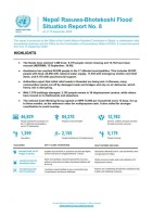
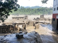
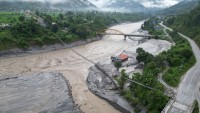
The renewed threat comes less than a month after the devastating Bhote Koshi flood of August 26, which severely affected riverbank areas of Rasuwa, Nuwakot, Dhading and Gorkha. The Government of Nepal has described the long-term rehabilitation of affected communities as an urgent priority.
Nepal has an extensive network of rivers, streams and seasonal waterways. Government hydrological documents describe approximately 6,000 rivers and rivulets, including permanent and seasonal streams and creeks. The major Koshi, Gandaki and Karnali river systems drain the country from the Himalaya towards the plains, where rivers frequently spread across broad floodplains during the monsoon.
This geography has historically encouraged settlement along waterways. River corridors provide water, fertile agricultural land, transportation routes, trade opportunities and access to markets. Consequently, riverbank settlements can be found across virtually every part of Nepal-from Himalayan trading centres and highway bazaars to rapidly expanding cities and densely populated Tarai communities.
A nationwide pattern of riverbank exposure
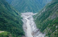
In the Himalayan and mountain corridors, settlements along the Bhote Koshi, Trishuli, Marsyangdi, Kali Gandaki, Arun and other rivers are exposed not only to conventional floods but also to debris flows, landslides, GLOFs and sudden changes in river discharge.
Important settlements and commercial centres such as Rasuwagadhi, Syabrubesi, Trishuli, Devighat, Galchhi, Malekhu, Beni and other river-corridor markets have developed around strategic transport and trade routes. The August disaster demonstrated how rapidly a river event can damage roads, bridges, hydropower infrastructure and settlements simultaneously.
The Government's official disaster appeal following the August 26 Bhote Koshi flood specifically identified serious impacts in Rasuwa, Nuwakot, Dhading and Gorkha, while emphasizing both immediate rescue and longer-term rehabilitation.
In the middle hills, expanding road networks have accelerated settlement growth along river terraces and floodplains. Towns and market centres around the Arun, Tamakoshi, Sunkoshi, Seti, Madi, Bheri and other tributaries increasingly combine residential, commercial and transport functions.
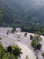
In the Tarai, the risk takes a different form. Large populations live on broad floodplains around the Karnali, Narayani, Rapti, Babai, Mahakali, Kankai, Bagmati and other rivers. Riverbank erosion, inundation, sediment deposition and shifting channels can affect agricultural land, homes and transportation infrastructure over large areas.
Kathmandu Valley illustrates the urban dimension
Riverbank settlement is not only a rural or Himalayan issue. Kathmandu Valley's Bagmati, Bishnumati, Manohara, Hanumante, Nakkhu and other waterways pass through some of Nepal's most densely developed urban areas.
Impermeable surfaces, encroachment, inadequate drainage and settlement close to waterways can increase the consequences of intense rainfall. Recent analysis has noted that even comparatively moderate rainfall can create flooding problems in parts of heavily urbanised Kathmandu because of drainage and river-channel constraints.
Heavy rainfall expected from September 24-28
DHM has been monitoring a low-pressure system that developed over the Bay of Bengal. Forecast information indicates increasing rainfall activity across Nepal, with September 25-27 identified as a particularly important period.
The latest forecasts indicate the possibility of heavy to very heavy rainfall in parts of Gandaki and Lumbini, with extremely heavy rainfall possible at isolated locations. Heavy to very heavy rainfall is also possible in parts of Madhesh, Koshi, Bagmati and Sudurpashchim, while some areas of Karnali could receive heavy rain.
Authorities have warned of possible floods, landslides, debris flows, soil erosion and inundation, as well as disruption to road and air transportation.
The National Disaster Risk Reduction and Management Authority has strengthened preparedness, including real-time monitoring of rivers and coordination with DHM and the flood forecasting authorities. Government agencies have also been instructed to keep emergency equipment ready along vulnerable roads and highways.
DHM's rainfall monitoring system considers accumulated rainfall of 140 mm in 24 hours a warning threshold associated with potential threats including landslides on steep slopes and high local river flows.
From disaster response to safer settlement planning
The latest forecast highlights a larger question for Nepal: how safe is it to continue expanding settlements, markets and infrastructure directly beside rivers and on active floodplains?
The answer cannot simply be to remove vulnerable communities. Riverbank populations include farmers, workers, traders, landless families and long-established communities whose livelihoods depend on proximity to water and transport corridors.
Effective risk reduction therefore requires a combination of scientific flood-risk mapping, enforceable river setback zones, early-warning systems, safer bridges and roads, resilient water and sanitation infrastructure, flood-resilient housing, managed relocation where unavoidable, and adequate compensation and livelihood support for genuinely displaced households.
For Nepal's 77 districts, river management must increasingly become part of land-use planning rather than being treated only as an emergency-response issue.
As the country enters another period of potentially intense rainfall, authorities are urging people to remain updated through official forecasts, avoid unnecessary long-distance and nighttime travel, and stay away from swollen rivers and streams. DHM operates a national warning system for rainfall and floods and provides the toll-free 1155 number for weather and flood information.
For communities already living beside Nepal's rivers, the coming days will again demonstrate that where people build, how they build and how quickly warnings reach them can be as important as the amount of rain that falls.
#EcosphereNews #Nepal #RiverBankSettlements #FloodRisk #ClimateChange #ClimateResilience #ExtremeWeather #Monsoon #HeavyRainfall #Floods #Landslides #EarlyWarning #DisasterRiskReduction #RiverManagement #ClimateAdaptation #NepalRivers #Koshi #Gandaki #Karnali #Bagmati #ClimateJustice #SustainableDevelopment #ResilientNepal #Asoj2083