Washington, August 24, 2026 - Across parts of the United States, a hidden ingredient in the atmosphere is helping set the stage for increasingly dangerous rainfall: an unusually moisture-rich atmosphere.
The phenomenon is not visible to the human eye, but its consequences are becoming impossible to ignore. When the atmosphere contains abundant water vapour and weather systems remain slow-moving or repeatedly develop over the same areas, enormous quantities of rain can fall within a short period, overwhelming rivers, drainage systems and communities.
Recent flooding in central Indiana provides a striking example. According to the U.S. National Weather Service, a wet pattern persisted across central Indiana from August 11 to 17, allowing multiple rounds of thunderstorms and heavy rain to move across the same areas. Some locations received more than a foot of rainfall, producing numerous water rescues, washed-out roads and extensive property damage. The White River reached levels not seen since 1913 at some locations, with several records established.
The atmospheric setup is crucial. A storm does not manufacture all of its rainfall from nowhere; it draws moisture from the surrounding atmosphere. When unusually humid air is transported into a region, there is simply more water available for storms to convert into precipitation.
If storms then repeatedly pass over the same location, rainfall can accumulate at extraordinary rates. The result can be a rapid transition from heavy rain to flash flooding and, subsequently, prolonged river flooding.
NOAA explains that severe flooding can result from atmospheric conditions producing heavy rainfall, while geography also determines how vulnerable a particular location is. River valleys, urban areas and places with limited drainage can be particularly susceptible.
A warmer atmosphere can hold more moisture
The phenomenon also has a broader climate dimension.
As the atmosphere warms, its capacity to hold water vapour increases. NOAA's climate research notes that a warmer Earth can become a wetter Earth in many regions, with increasing potential for heavy precipitation.
This does not mean that climate change directly caused every flood occurring in the United States. Individual floods are produced by a combination of atmospheric circulation, storm development, moisture availability, soil conditions, topography and land use.
But a warmer atmosphere can increase the amount of moisture available when the right weather pattern develops-raising the potential for more intense rainfall.
El Niño adds another piece to the puzzle
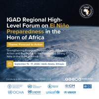
The large-scale climate pattern is also changing. NOAA recently announced that El Niño has developed in the tropical Pacific and is expected to strengthen. El Niño changes atmospheric circulation patterns around the world and can influence where moisture and storms are concentrated.
However, scientists caution against attributing individual flooding events simply to El Niño. The connection is more complicated: El Niño can influence the broader atmospheric pattern, while local and regional weather systems determine when and where extreme rainfall actually occurs.
Indiana shows how the ingredients can combine
The recent central Indiana event demonstrates the danger of repeated rainfall particularly well.
After multiple rounds of storms, excessive rain left rivers elevated and soils saturated. Even after the heaviest rainfall ended, the effects continued downstream. As of August 23, the National Weather Service was still maintaining flood warnings along portions of the White River and Wabash River systems because of excessive rainfall accumulated over the preceding weeks.
This is an important lesson for flood-prone regions worldwide:
The danger is not determined only by how much rain falls in a single storm. It also depends on how much rain has already fallen, how saturated the landscape is, how quickly water can drain and whether additional storms arrive before rivers and soils recover.
The bigger global warning
The U.S. experience is part of a wider climate risk confronting communities around the world.
From South Asia and the Himalayan region to Europe, East Asia and the Americas, extreme rainfall can become particularly destructive when intense precipitation intersects with vulnerable landscapes, expanding cities, degraded watersheds and inadequate drainage infrastructure.
The science therefore points toward a more sophisticated understanding of climate-related flooding. Climate change does not create every storm, but warming can alter the background conditions in which storms operate.
For policymakers, planners and communities, the message is increasingly clear: preparing only for historical rainfall records may no longer be sufficient. Flood-risk planning must account for the possibility of more intense precipitation, changing hydrological conditions and increasingly complex interactions between climate, land use and extreme weather.
The invisible water vapour in the atmosphere may be impossible to see-but when weather systems unlock it, the consequences can become devastatingly visible.
Ecosphere News will continue to follow the growing links between extreme weather, climate change, water security, ecosystem resilience and human vulnerability-because understanding the science behind disasters is essential to building safer and more climate-resilient societies.
Sources
NOAA, National Weather Service and NOAA National Centers for Environmental Information.
#EcosphereNews #ClimateChange #ExtremeWeather #Flooding #ExtremeRainfall #ClimateCrisis #WaterSecurity #WeatherExtremes #ClimateResilience #NOAA #UnitedStates #GlobalClimate #EnvironmentalNews #Sustainability #ClimateAction