Kathmandu - The catastrophic glacier-related disaster that struck the Nepal-Tibet border region in late August 2026 has raised an urgent scientific question: can researchers predict when a glacier-or an unstable mountain slope containing ice-will collapse before it becomes a deadly flood?
The short answer is not yet with exact precision. Scientists cannot currently predict the precise day, hour or minute when a massive glacier, ice mass or high-mountain slope will fail. However, advances in satellite technology, radar, drones, seismic monitoring and automated sensors are increasingly helping researchers identify dangerous areas and detect warning signs of accelerating instability.
The recent Himalayan disaster has demonstrated why this capability is becoming increasingly important.
A Disaster That Exposed a Major Warning Gap
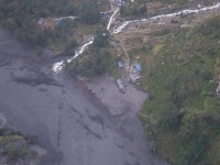
Preliminary assessments indicate that the devastating flood was triggered by a major collapse involving ice, rock and mountain debris, setting off a cascading chain of events through Himalayan river systems.
Unlike conventional monsoon floods, which can often be forecast using rainfall data and river-level monitoring, such disasters can occur suddenly-even under relatively clear skies. This creates what experts describe as a serious gap in traditional flood-warning systems.
Existing systems are generally designed to monitor:
Heavy rainfall
Rising river levels
Weather forecasts
Glacial lakes
But they are often less capable of detecting a sudden high-altitude glacier or mountain collapse before the resulting avalanche, debris flow or flood races downstream.
The World Meteorological Organization (WMO) has described the Nepal disaster as a stark example of cross-border and cascading risks, warning that rising temperatures are altering glaciers, snow conditions, permafrost and mountain slopes across the Hindu Kush Himalaya.
Scientists Can Identify Warning Signs-But Exact Prediction Remains Difficult
Scientists are increasingly able to monitor several indicators that may suggest growing instability, including:
Cracks and fractures in glaciers and ice masses
Accelerating glacier movement
Rock-slope deformation
Thawing permafrost
Rapid snow and ice melt
Changes in glacial lakes
Unusual temperature conditions
Heavy rainfall and water infiltration
Small seismic signals and ground movement
Satellite imagery and radar can now observe remote Himalayan terrain that is difficult or dangerous for scientists to reach on the ground.
In the aftermath of the recent Nepal-China border disaster, authorities have used radar and drones for round-the-clock monitoring of unstable lakes and mountain conditions, illustrating how technology can help detect secondary hazards after a major collapse.
However, identifying an unstable mountain is not the same as predicting exactly when it will collapse.
A mountain slope may remain unstable for years before failure. Conversely, a collapse can sometimes occur suddenly after a combination of warming, melting ice, rainfall, rock fracture or other physical changes pushes the system beyond a critical threshold.
From “Flood Forecasting” to “Mountain System Monitoring”
The latest disaster has strengthened calls for a major shift in Himalayan risk management.
Scientists increasingly argue that authorities should not monitor only individual hazards such as rivers or glacial lakes. Instead, they need to assess the entire mountain system.
A cascading disaster may follow a chain like this:
Rising temperatures → Permafrost thaw → Mountain slope instability → Rock and ice collapse → Avalanche or debris flow → River blockage → Temporary lake formation → Dam failure or overflow → Catastrophic downstream flood
This means that monitoring a river alone may be too late.
The recent disaster showed how a collapse high in the mountains can rapidly create new hazards downstream, including debris-dammed lakes and the risk of secondary flooding.
Climate Change Is Increasing the Risks
Scientists are still cautious about directly attributing any single glacier collapse entirely to climate change. A detailed scientific investigation is required to determine the exact triggers behind an individual event.
However, the broader scientific evidence is clear: a warming climate is transforming high mountain environments.
The WMO's latest assessment of Asia reported that retreating glaciers, extreme rainfall, flooding and other climate-related hazards are increasingly affecting the region, highlighting the urgent importance of stronger observations and early warning systems.
In the Hindu Kush Himalaya, warming temperatures can contribute to:
Glacier retreat
Permafrost degradation
Formation and expansion of glacial lakes
Increased rock-slope instability
More frequent avalanches and debris flows
Greater risks of glacial lake outburst floods
The recent Nepal disaster has therefore intensified concern that communities living downstream from glaciers may face increasingly complex and unpredictable hazards in the coming decades.
What Nepal and the Himalaya Need Now
Experts say the future of Himalayan disaster preparedness must involve multi-hazard early warning systems capable of monitoring more than rainfall.
Such systems could combine:
1. Satellite Surveillance
Regular high-resolution optical and radar observations can detect changes in glaciers, lakes and mountain slopes.
2. Ground-Based Sensors
GPS instruments, seismic sensors, cameras and automatic weather stations can provide continuous information from high-risk areas.
3. Real-Time River Monitoring
Automatic water-level sensors can rapidly detect unusual surges and trigger downstream warnings.
4. Drone and Radar Technology
Drones and ground-based radar can help monitor inaccessible and unstable mountain terrain.
5. Integrated Multi-Hazard Systems
Data from weather stations, satellites, glaciers, rivers and seismic sensors should be analysed together rather than separately.
6. Faster Community Warnings
Alerts must quickly reach vulnerable communities through:
Mobile phones
Sirens
Radio networks
Local governments
Hydropower operators
Emergency response teams
Scientific research on Himalayan glacial hazards has found that effective early warning systems can combine satellite monitoring with automatic weather and hydrological instruments, supported by strong communication networks for rapidly delivering warnings to communities.
Cross-Border Cooperation Is Essential
The Himalayan mountains and rivers do not follow political borders.
A glacier collapse, landslide or glacial lake outburst occurring in one country can create devastating consequences downstream in another. The Nepal-Tibet disaster has highlighted the urgent need for stronger cross-border monitoring, data sharing and emergency communication.
The WMO has stressed the importance of closing major observation and early-warning gaps across vulnerable mountain regions through sustained investment in monitoring and data-exchange systems.
The Future: Predicting Risk Rather Than the Exact Moment
For now, scientists may not be able to say:
“This glacier will collapse tomorrow at 10 a.m.”
But science is moving towards something potentially just as important:
identifying dangerous locations, detecting accelerating changes, estimating the likelihood of failure and providing earlier warnings when conditions become critical.
The goal is shifting from predicting the exact moment of collapse to creating a system that continuously asks:
Which mountains are becoming unstable?
What changes are occurring?
Who is downstream?
And how quickly can people be warned?
The devastating Himalayan disaster has delivered a powerful lesson for Nepal and the wider Hindu Kush Himalaya: the future of disaster preparedness cannot focus only on forecasting rain and floods. It must monitor the mountains themselves.
As climate change continues to reshape glaciers, permafrost and high-altitude landscapes, investing in advanced multi-hazard monitoring and early warning systems may become one of the most important tools for protecting millions of people living downstream from the world’s great mountain ranges.
The science may not yet be able to predict every collapse-but better monitoring could provide the critical warning needed to save lives.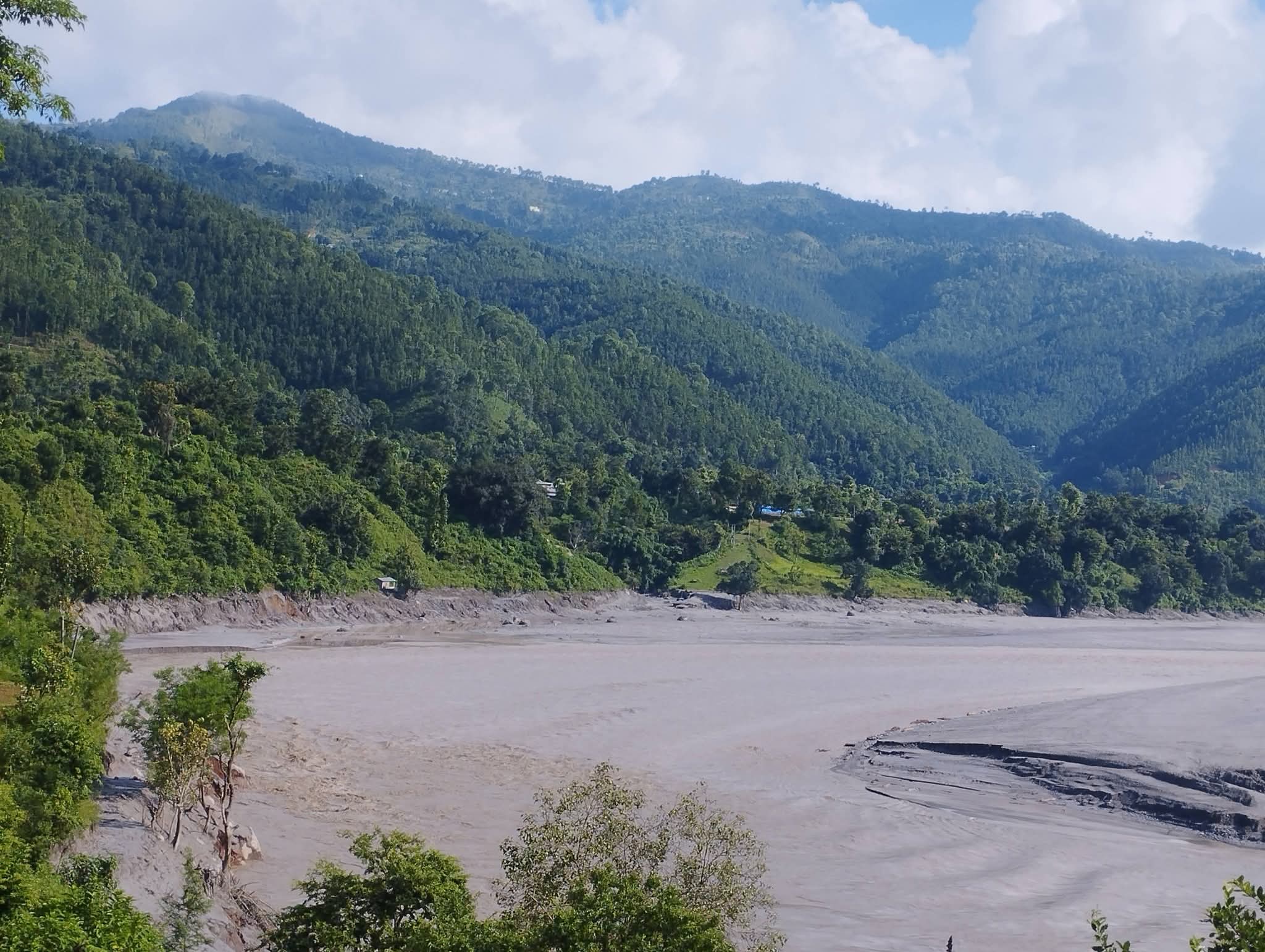
#GlacierCollapse #ClimateChange #Himalayas #Nepal #EarlyWarningSystems #GlacialFlood #ClimateCrisis #DisasterRiskReduction #HimalayanClimate #EcosphereNews